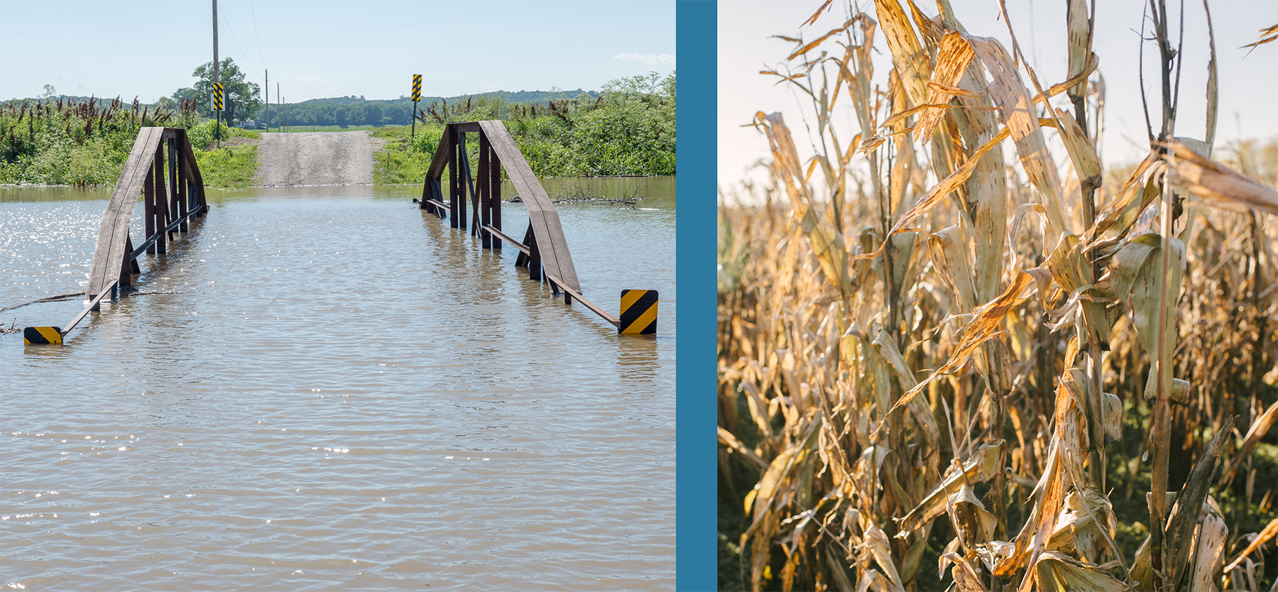
Missouri’s climate can hit extremes such as drought and flooding – sometimes in the same season.
In response to the devastating flooding in 2019, Governor Parson’s Flood Recovery Advisory Working Group, led by the Missouri Department of Natural Resources and the Missouri Department of Agriculture, along with stakeholders, laid the groundwork to suggest and prioritize much needed changes to the state’s current levee system.
In 2019, locations on the Missouri River were above flood stage for nearly 280 days, well surpassing the duration of both the 2011 and 1993 floods. More than 100 levees overtopped or breached, 1.2 million acres of farmland sat underwater, and approximately 470 roads were closed.
The Department of Natural Resources has been working on several projects to reduce the future damage caused by flooding.
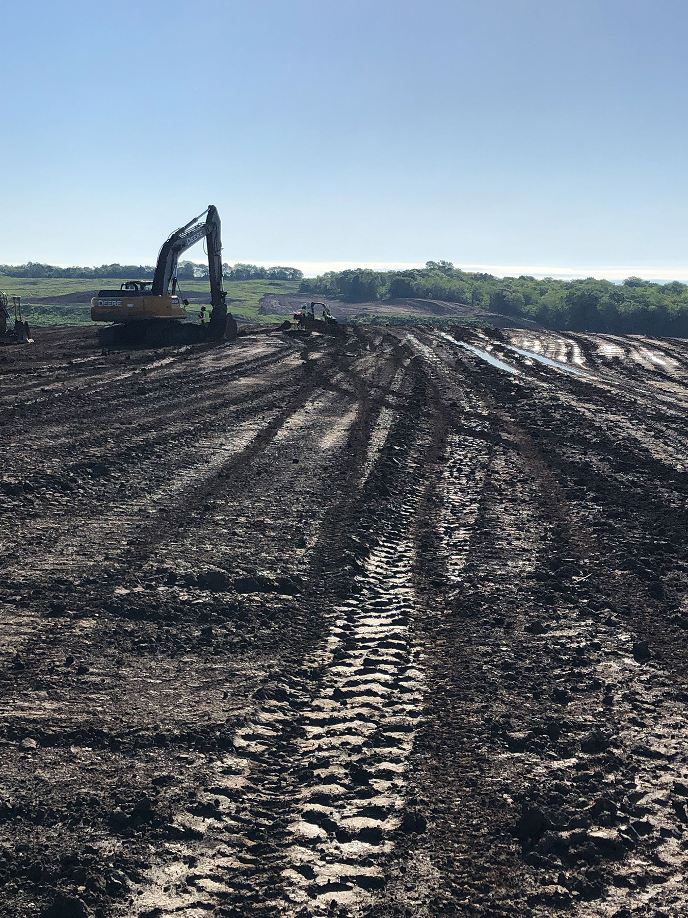
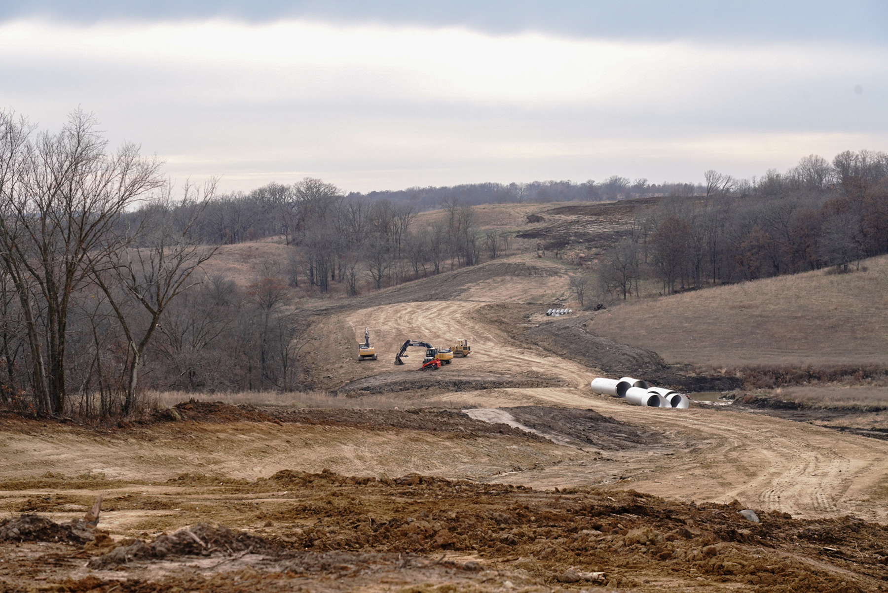
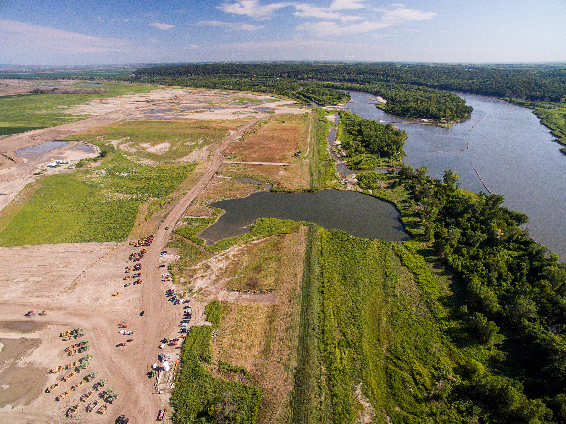
The first major project undertaken was the Atchison County levee setback, a highly complex $100 million levee setback, the largest such project on the lower Missouri River in many years. It provides increased protection from flooding and will reconnect the river to the historic floodplain after floodwaters destroyed most of the left bank of Missouri River Levee Unit 536 in northwestern Missouri. Setting back the levee provides more capacity to convey floodwaters without restricting flow.
The Atchison County levee setback project provided a successful guide to the benefits that can be gained with strong local leadership and partners committed to a shared goal: improving the quality of life for Missourians.
Building on the community support for the Atchison County levee setback project, the department’s Water Resources Center continues to work with external state, federal, landowner and citizen partners to develop new approaches to flood protection infrastructure on the Missouri and Mississippi rivers to reduce damages. More recently, department representatives have been meeting with local levee board members, county officials and the U.S. Army Corps of Engineers to discuss potential planning efforts to bring increased flood protection to Brunswick, Holt County and Jefferson City.
Reservoir projects tackle drought
Since it was created in its current form by the Missouri General Assembly in 2019, the Multipurpose Water Resource Fund has provided more than $4 million in funding to date to support water supply development projects. In addition, the Missouri General Assembly has further committed $24 million in the fund to support water supply development projects.
Caldwell and Sullivan counties, in northern Missouri, are especially susceptible to drought. In 2018, these counties were weeks away from losing all drinking water service. Two reservoir projects are underway to provide water supply stability in the area:
Little Otter Creek Reservoir
Caldwell County
The U.S. Army Corps of Engineers issued a Clean Water Act Section 404 permit, which the department certified with a Clean Water Act Section 401 water quality permit, and construction has begun. The 345-acre reservoir will provide drinking water to more than 9,000 citizens in Caldwell County.
Roy Blunt Reservoir
Sullivan County
The 2,352-acre reservoir will provide regional water supply, flood control and recreation for 10 counties in north-central Missouri. The Natural Resources Conservation Service, a federal partner on the project, signed a record of decision supporting the installation of the reservoir. Once the department issues a Clean Water Act Section 401 water quality permit and the USACE Section 404 permit is issued, construction can proceed beyond land clearance. In November, the USDA Rural Development awarded more than $45.7 million to help finance the project.
Missouri Hydrology Information Center
To meet Missouri’s comprehensive water needs, Water Resources Center hydrologists, geologists and engineers investigate and monitor surface water and groundwater resource characteristics, availability and use. In support of these activities, Governor Parson requested $10.4 million in funding to create a Missouri Hydrology Information Center.
Missourians will benefit from a total of $10.4 million in Missouri Hydrology Information Center projects this year.
- Streamgage network and expansion products – $1 million.
- Imaging products – $5.6 million.
- Aquifer supply and mapping – $1 million.
- Missouri Hydrology Information Center establishment and staff – $2.85 million.
The Missouri Hydrology Information Center will reside in the department’s Water Resources Center and will provide information in user-friendly formats to give citizens and communities usable and relevant information to help ensure their safety and protect property. Funding comes from the American Rescue Plan Act.
The department coordinated with other agencies, such as the National Oceanic and Atmospheric Administration, U.S. Geological Survey, Missouri State Emergency Management Agency and universities, to make sure resources complement and connect one another. Goals for the Missouri Hydrology Information Center include enhanced surface water monitoring and predictive capability to protect life and property, expanded soil moisture mapping, expanded water supply mapping and displays and providing readily accessible information about weather conditions.
Learn more about MoHIC at dnr.mo.gov/water/hows-water/mo-hydrology-information-center-mohic.
Reporting drought conditions
Reports and photographs are essential tools used to assess drought conditions. The department encourages the public to submit information and photographs about conditions in their area to help local, state and national decision-makers assess drought conditions and impacts in Missouri. If you would like to submit drought-related conditions and impacts for your area, please fill out the survey form at Condition Monitoring Observer Reports.
This is a nationwide service provided by the National Drought Mitigation Center, based at the University of Nebraska-Lincoln, developed in partnership with the National Integrated Drought Information System and the U.S. Department of Agriculture. Your report will become part of the permanent record, appearing immediately on an interactive map visible to the public, including authors of the U.S. Drought Monitor and the media.